The Romans never much liked the Riviera. They found its stony slopes too tiresome for agriculture, its small settlements too poor to plunder, and its mountainous interior too difficult to protect against the troublesome natives.
Which is why the Romans did not settle in great numbers here and only ever built a few garrisons in coastal enclaves that were easy to defend, creating just enough of a presence to ensure a safe transport of their troops from central Italy to the Rhone valley whose fat and fertile lands were far more to their liking.
Consequently, the main Roman legacy in the area is the Via Iulia Augusta, the road that connects southern France – the “Provence” – with the Roman heartlands.
One of the best preserved stretches of this ancient road leads from Albenga – the largest Roman garrison on the Riviera – to Alassio and is nowadays a popular hiking route.
Hiking a stretch of Via Iulia Augusta from Albenga to Alassio
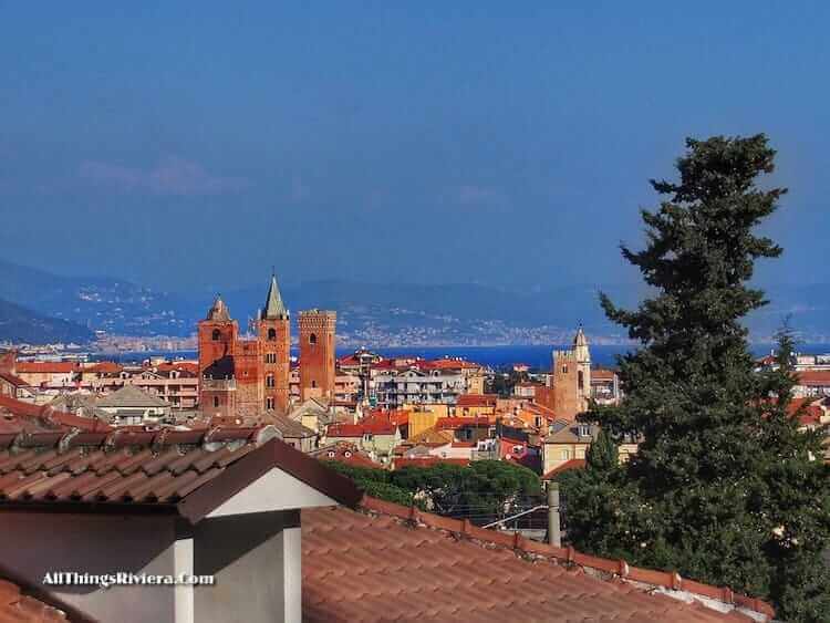
We begin our walk in Albenga, which in itself is worth a look. Rare for a town on the Riviera coast, Albenga is steeped in history and features many buildings from antiquity including a cathedral with foundations from the 3rd century.
Once you have completed your tour of the old town, cross the river Centa on the Via Piave bridge. Continue until the roundabout where you must turn right into Via Calocero and then follow the signs to Via Iulia Augusta.
On the old road’s gently climbing slope, take one last look back on the “city of 100 spires”, as Albenga is apparently called (by Baron Münchhausen, presumably – or the same guy who counts crowds at Donald Trump rallies on behalf of the White House Press Office).
In terms of size, the Roman settlement of Albinga Unum was no match for Arles or Nimes further to the west, but still large enough to have proper residents and consequently to require proper Roman graveyards.
The Romans never buried their dead inside the city walls, so the Via Iulia Augusta – like all roads leading to and from Roman towns – would have been lined with individual graves (which have mostly disappeared) but also with funerary monuments for large and influential families.
Excavations of graves along the road have been provided with information panels that display explanations and images of reconstructions to help you imagine how those buildings would have looked in Roman times.
Some of these buildings must have been almost monumental in scale …
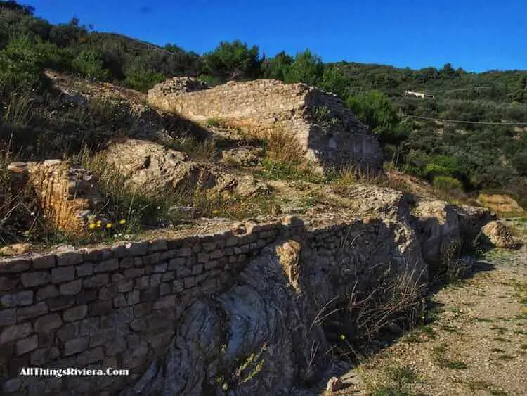
… but most were fairly modest.
Some buildings were, over the centuries, probably used for other purposes …
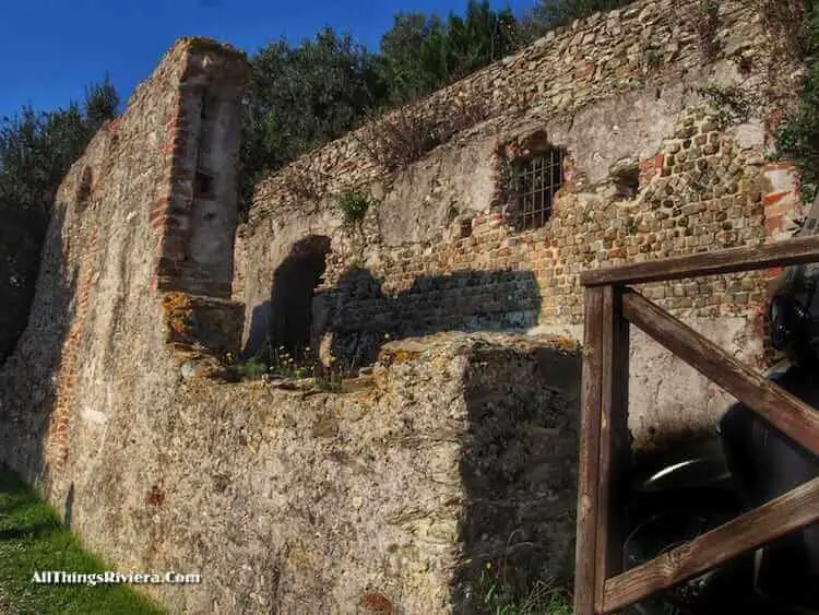
… while of those that were not little is left but their foundation stones. That, and the beautiful views.
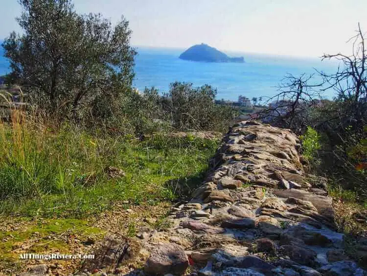
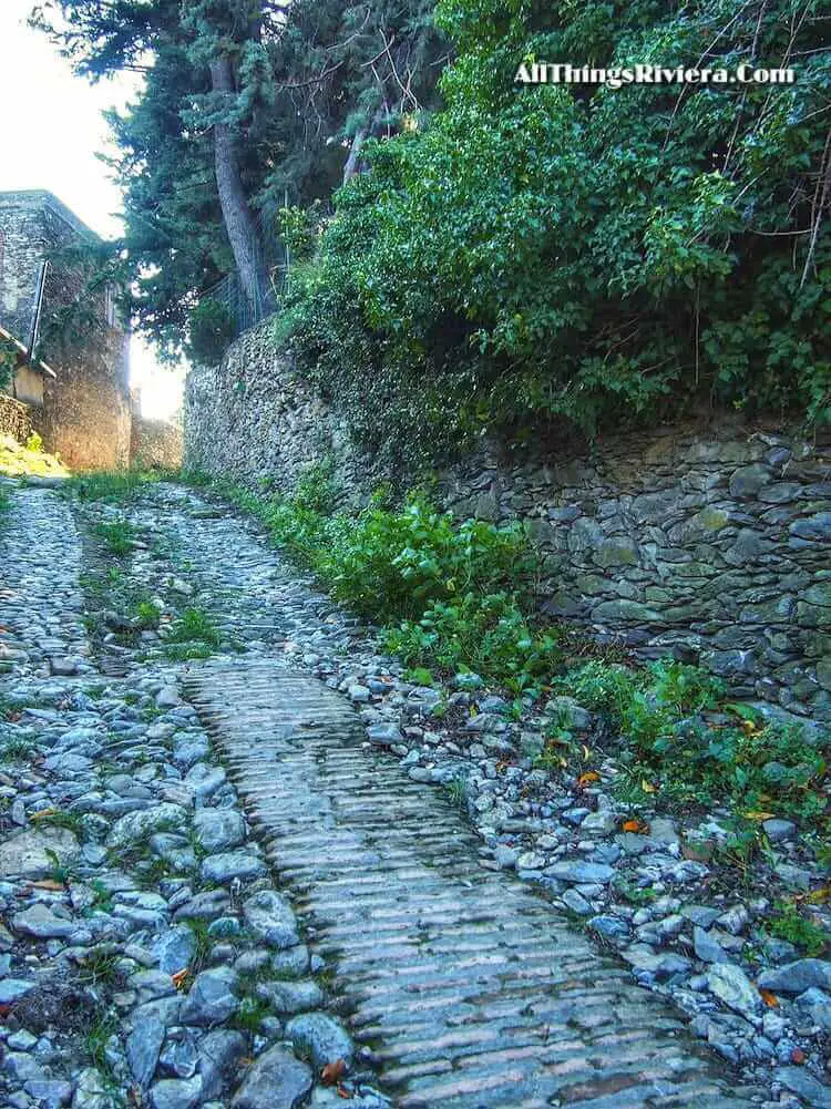
It is important to realize that the Roman road itself has only been preserved in its outline, while any pavement that must have covered it once has long fallen victim to landslides and gradual erosion.
You will come across the oldest section of the actual road surface at approximately the half-way point of the walk.
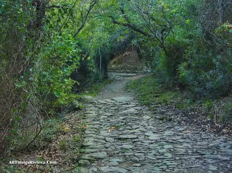
This pavement was only revealed in 1937 by an archeaological dig and caused much furore at the time when it was initially assumed to be of antique origin. This theory, however, soon had the cold water of fact and probabilities poured all over it.
The stones are today believed to come from the Middle Ages, but still: we do not walk every day on stones that were laid down more than 500 years ago.
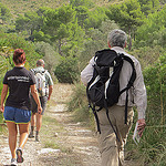
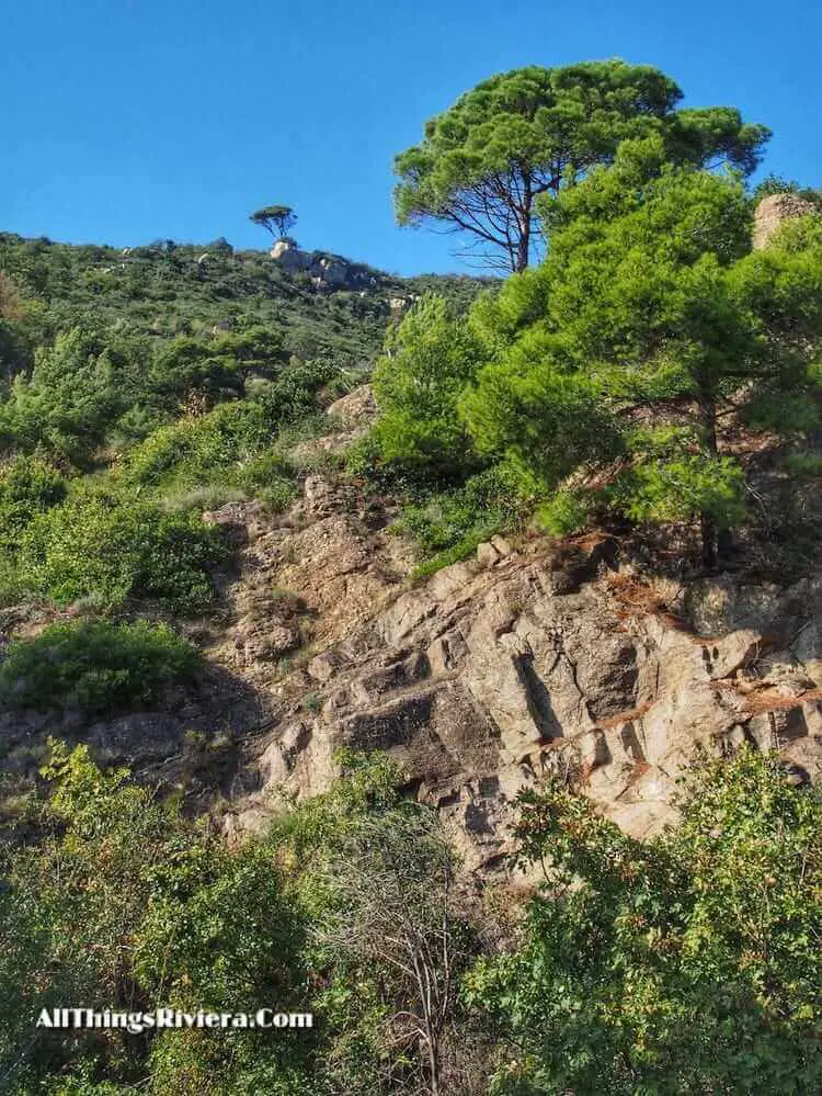
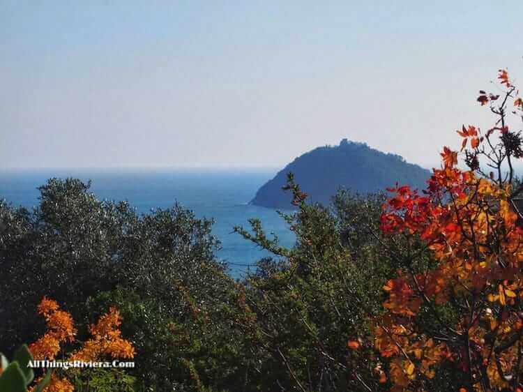
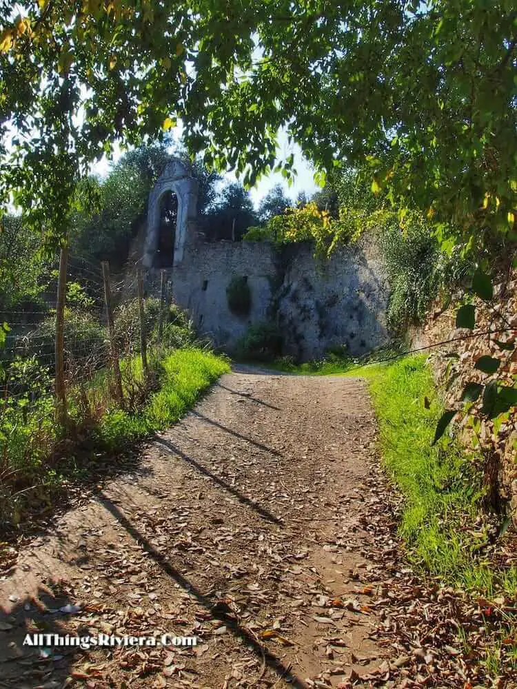
Archaeology aside, the walk has also many points of interest for people who could not give two hoots about Roman funerary customs.
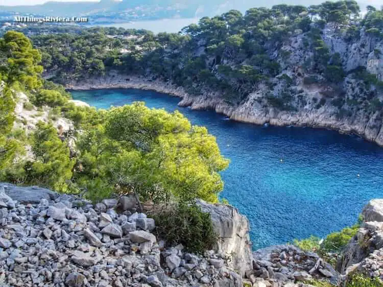
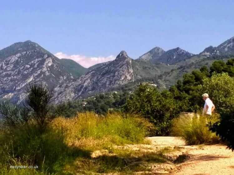
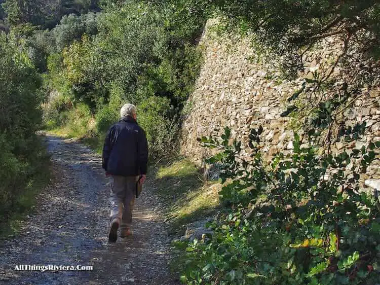
There is the impressive mountain scenery …
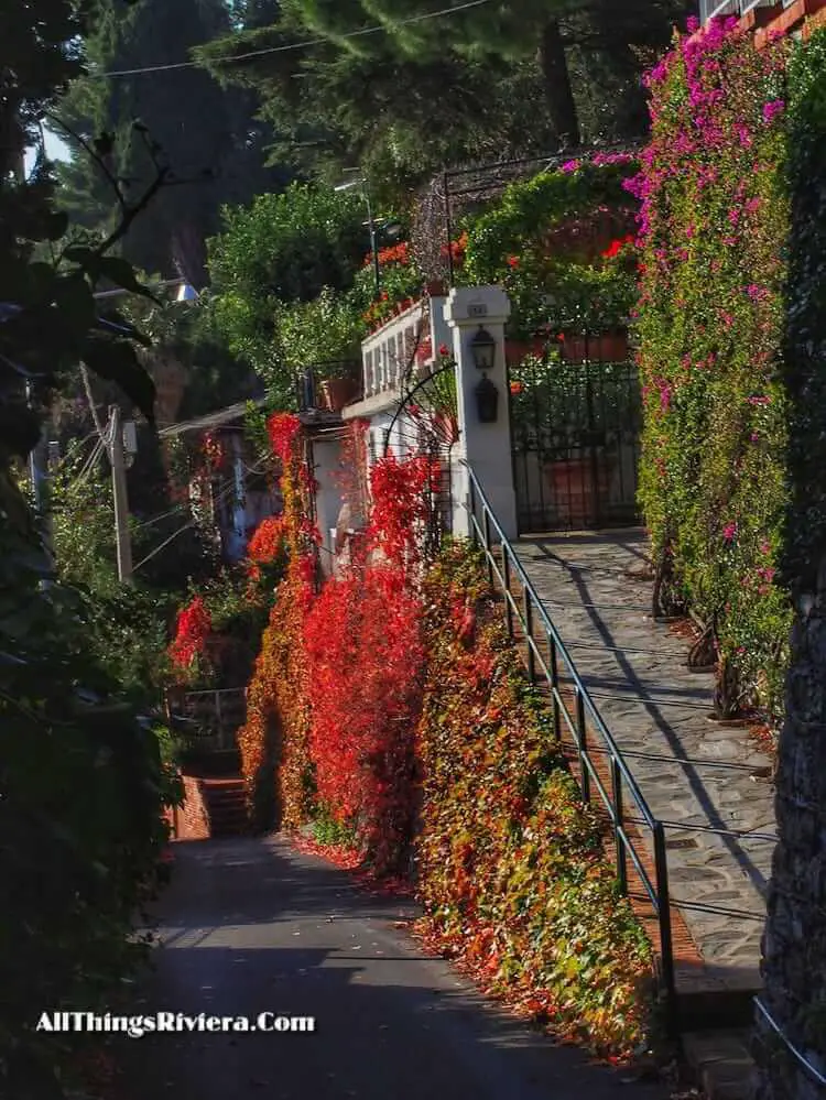
… there are autumnal splashes of colour, a relatively rare thing in this part of the world …
… and there is romantically dishevelled architecture of a more recent vintage.
The trail is mainly lined by olive orchards: which can give you a hint of why the Romans never bothered to develop the Riviera coast. Long and high stone walls are required to prevent the ground underneath the olive trees from sliding into the Mediterranean Sea.
Why would the Romans undergo the pain of constructing them? They had, after all, enough land in Italy where to grow their olives. It was less tiresome and probably even cheaper to import the oil for their local cooking pots from Puglia. The Romans were, above all, practical people.
The walk (of approx. 2 hours) ends at the chapel of Santa Croce, a nice place for an al fresco lunch, provided you have thought of bringing the lunch. (There is plenty of al fresco around, but no place to buy anything between Albenga and Alassio.)
If you still have the energy, you can walk to Alassio via the Strada Panoramica to take the hike we have described here, albeit in reverse order.
Do not try to descend by using Via Byron. It is far better, if you are in a hurry, to use the low road parallel to the Panoramica, called Strada Romanica, which will take you to Alassio in approx. 30 minutes.
It is less panoramic than its near neighbour, as advertised, but not entirely without charm.
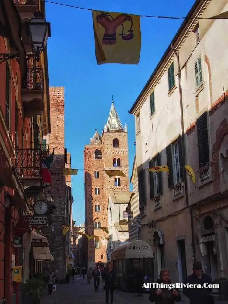
Overall, this stretch of Via Iulia Augusta is a great walk for the first-time visitors of the Italian Riviera. It combines panoramic views of mountains and seaside with a bit of history, and the opportunity of visiting two very different seaside towns: Albenga and Alassio, proud and beautiful but dozy the one, lively but perhaps a little bit shallow the other.
Over your dinner, you can discuss which of the two you have liked better. Practical people like the Romans, I suspect, would not need much time to make up their minds.