Six weeks ago, we finished our walk down the most celebrated stretch of the French Riviera in the place where the Promenade des Anglais, while continuing down the Bay of Nice, becomes the Quai des Etats Unis.
“To the casual observer,” I finished the post, “this is a mere change of name: a barely perceptible and wilful distinction, but the distinction has deep roots in the city’s history. We will return some other day to elaborate on this and to continue the walk along the Baie des Anges all the way to the port.”
This is what we shall do today: continue and reveal the roots. While, just like the last time, enjoying the splendid views, of which there are many.
But first, back to the city’s history. Most of the world’s national borders are formed by clearly visible entities: by oceans or by mountain ranges.
Rivers, meanwhile, can divide towns as well as countries: Paris, for example, has a Left Bank and a Right Bank, while London has a North and a South, and the locals of either city are well aware of the distinctions that this imposes.
Sometimes, however, borders are more difficult to spot: modern countries may meet where medieval warlords with different loyalties once drew a line in the sand – and sometimes, borders can become invisible over time.
One good example for the latter is the river Paillon in Nice. It used to separate, quite visibly, …
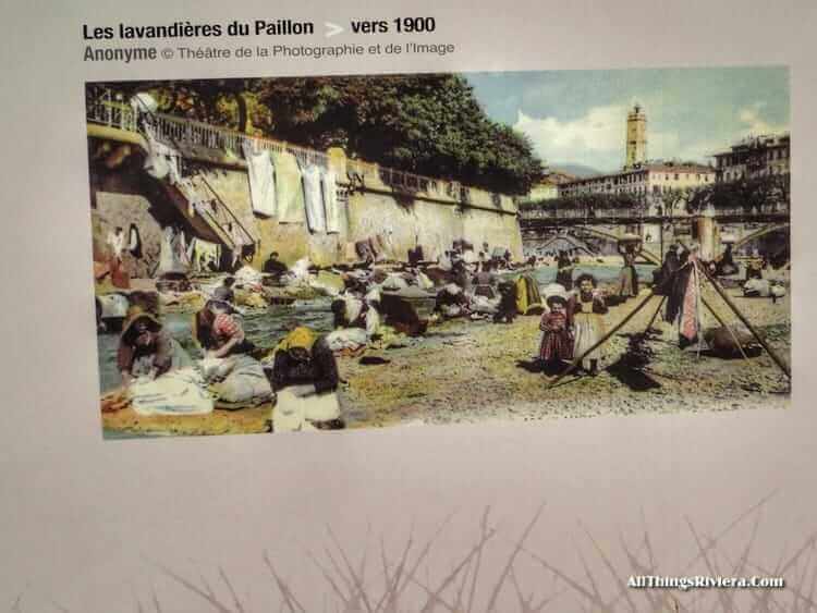
…the Old Town from the scattered settlements of the Anglais and other foreigners, residences that eventually gelled and hardened into the structures of the New Town.
On the two banks of the Paillon, two different worlds existed side-by-side: wealthy foreigners on one side, impoverished locals on the other.
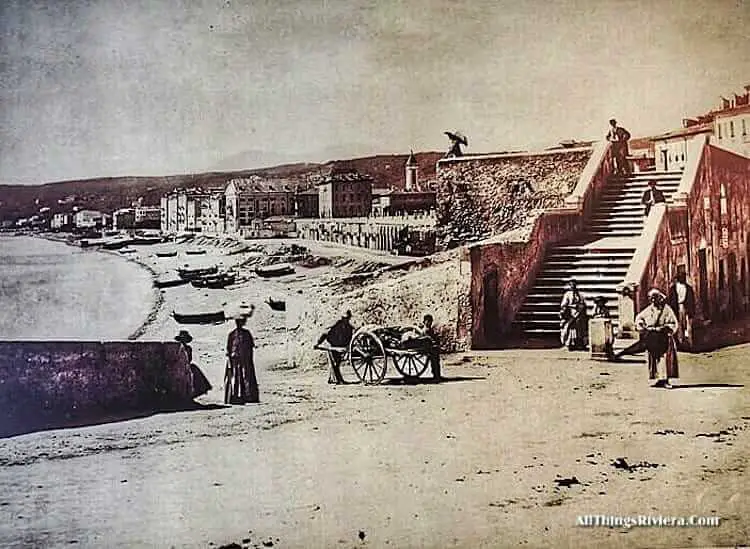
The Paillon still carries melted snow and rainwater from the mountains into the Mediterranean, but nowadays does so underground. It is a fairly big river by the region’s standards: certainly big enough to cause frequent damage through flooding in the past, which is why it was gradually built over from the mid 19th century onwards. The last bit of the river was buried by concrete in 1972.
The Paillon reaches the sea pretty much in the place where the Quai des Etats Unis starts. In ancient times, coastal walkers would, from now on, have had the city wall on their left hand side.
Only a few fragments are left of this wall, but the low silhouette of the modern buildings echo the shape of the old fortifications.
In the old days, there would have been only a single gate on the sea-facing side of the wall, reflecting the fact that – with the river Paillon in the west and the Castle Hill in the east – danger to the city was mainly expected to come from the sea.
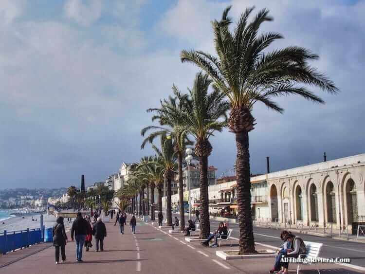
The modern city, conversely, has been built to embrace, not to fear the sea, and the wall of buildings on your left hand side allows you frequent peeks into the side streets all the way to the Cours Saleya, the busy heart of Nice’s Old Town.
This may be as good a time as any to remember one of the more unusual foot notes in the Prom’s history: its past as a track for motor racing.
The stretch from the Quai des Etats Unis to the Hotel Negresco was used seven times between 1932 and 1947 for the Grand Prix d’Automobiles de Nice …
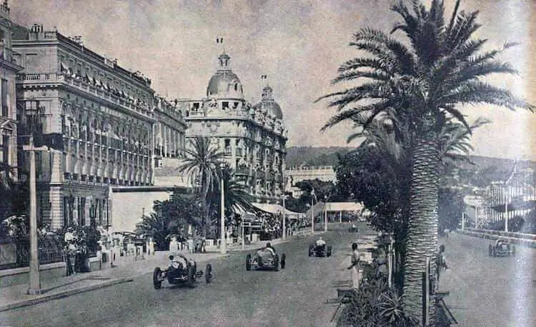
… while earlier still, before WWI, this was the coastal road on which the fastest cars of the period competed for the Coupe Rothschild.
In April 1902, Léon Serpollet even broke the world speed record here, reaching 120.8 kph in a steam-powered vehicle he himself had engineered.
The Quai also provides the background for the street’s most famous urban art work, the deceptively two-dimensional La Chaise by Sabine Geraudie.
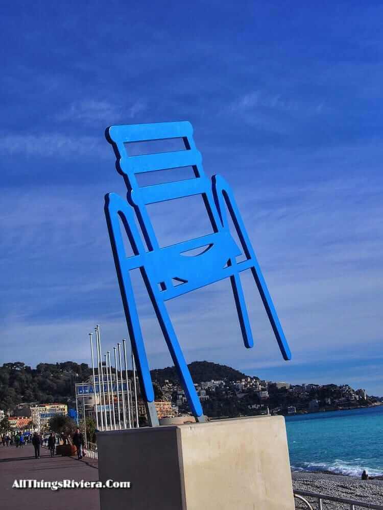
This is, without a question, the Riviera’s most photographed chair and one of its most reproduced images, lately even on the label of a local wine.
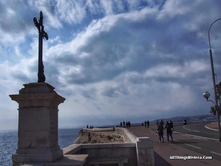
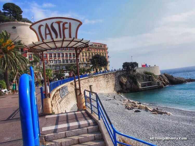
Just before the Hotel Suisse, the coastal boulevard once again assumes a new name and a new identity, becoming the Quai Rauba Capeu and a wide, wind-swept cliff-side highway …
… which also features, on the promontory that juts out into the Mediterranean Sea, what may very well be the city’s most photographed landmark.
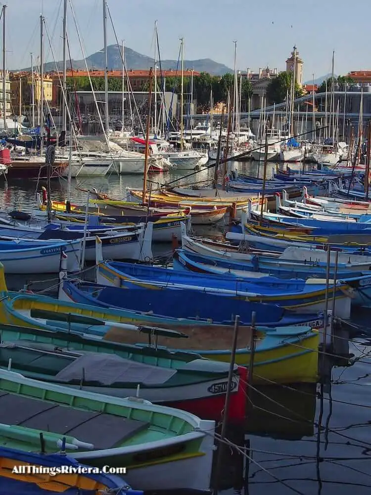
Round the Cap de Rauba Capeu and stroll into the harbour on the eastern side of the Old Town, …
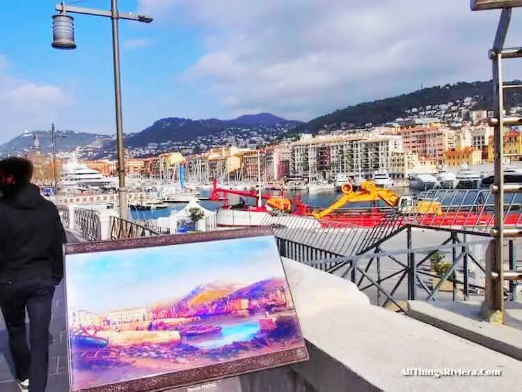
… a pleasant mix of busy ferries, heading for Corsica and beyond, of luxury yachts and of small fishing boats.
Towards the end of the harbour, turn left and make your way to Rue Catherine Segurane and eventually to Place Garibaldi, the grandest square in the Old Town.
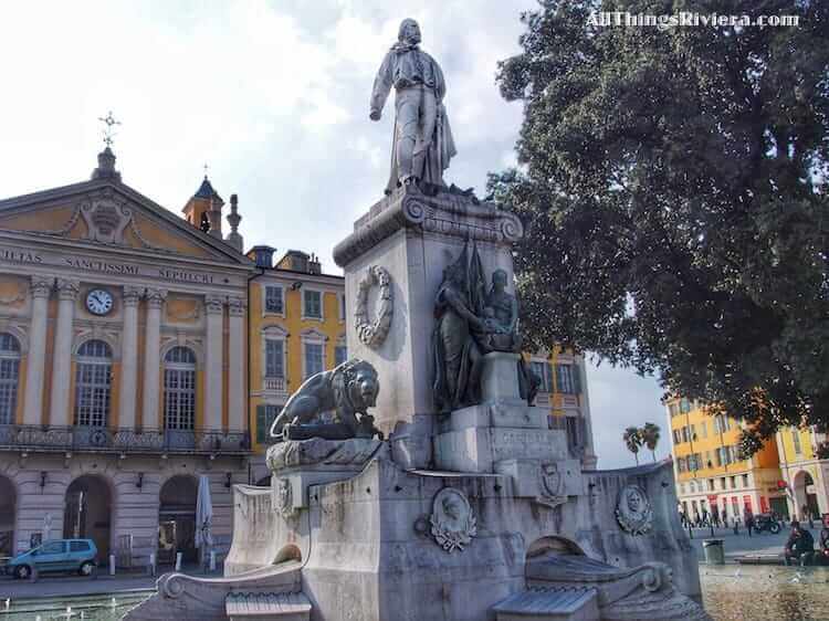
The piazza was named after Italy’s national hero who was born and grew up in Nice when it was called Nizza and (for most of the period) part of the Kingdom of Sardinia and Piemonte.
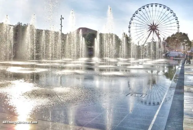
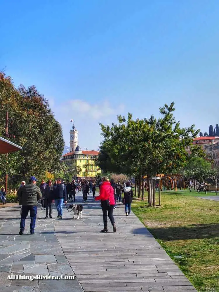
Leave the Garibaldi statue on your left and cross over diagonally to the Jardin de Paillon, Nice’s new showpiece park.
This area was an eyesore for 40 years, when – following the disappearance of the last bridge across the Paillon river – it became the home of extremely utilitarian buildings including multi-storey car parks and the central bus station.
A major urban regeneration scheme changed all that, and since its completion in 2011, the Paillon is – once again – at the heart of the city.
And if you feel peckish, you may be interested to learn that one of the city’s most popular vendors of Socca (the local specialty snack of pancakes made from chickpea flour) is just a stone’s throw away.
It is called Specialites Nicoises Socca and located on the corner of Rue Miralheti and Rue Pairoliere just off the Place Garibaldi. We recommend you buy your Socca at the stall there and eat it, while it is still hot, on one of the many benches in the park before strolling back to the Promenade des Anglais.
Finally, here is a tip that may make your life easier if you have come here from a holiday base in the north or the west of Nice: you do not have to walk all the way back to the train station to return but can instead catch a Ligne d’Azur overland bus straight to Cannes, Grasse or Vence from the Jardin Albert 1er.
It’s more convenient – and a lot cheaper, too. (Buses in the direction of Monaco and Menton leave from the old port.)